
Etroubles Chez-Les-Blancs – Pointe Chaligne
Route Description
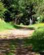
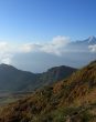
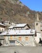
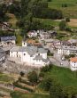
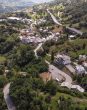
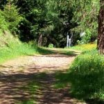
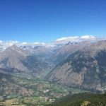
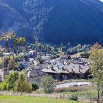
The adventure begins shortly after leaving the car, upstream from the picturesque hamlet of Chez-Les-Blancs Dessus, in the commune of Étroubles. Following the route marked number 4, we enter a small valley that shortly afterwards guides us to the rising ridge towards Praz-Gallet, 1626 meters above sea level. Continuing along a farm road, we come to a fork: here, taking a left and continuing to follow trail marker No. 4, we reach Alpe Ars, at an elevation of 1975 meters. From here, the route offers two alternatives: continue on the dirt road or take the path that winds upstream from the pasture. Both routes lead to the Tardiva Alp, at an elevation of 2220 meters. The final section begins at the pass of the same name, where you take trail No. 3 on the right, following the ridge that then curves gently to the left until you reach the summit of Pointe Chaligne. This last segment of the route is distinguished by its more rugged nature and spectacular views of the surrounding landscapes. Tips for the Hike
Preparation: Make sure you are in good physical shape and have adequate equipment, such as hiking boots, backpack with water, food, clothing suitable for weather variations, and a map or GPS.
Safety: Find out about weather conditions before setting off and, if possible, travel with company.
Respect for the environment: Keep the trails clean, don’t leave litter, and respect the local flora and fauna. The Fascination of Pointe Chaligne
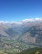
Reaching the summit of Pointe Chaligne is an experience that rewards the hiker with a 360-degree view of the majestic mountains of the Aosta Valley, a panorama that enchants and lingers in the memory. This trail is not just a hike, but a journey through the history, nature, and traditions of a land full of wonders.


-
1
voulpellière – prenoud
Saint-Oyen, AO, Italia
Chez-Les-Blancs – Pointe Chaligne
- Etroubles

Tour du Mont Fallère
- Etroubles
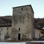
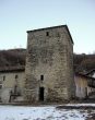
tower of vachery
- Etroubles
Bionaz
Distanza da Aosta 25.1 Km
Doues
Distanza da Aosta 14.6 Km
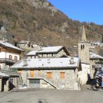
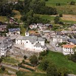
Etroubles
Distanza da Aosta 18.3 Km
Gignod
Distanza da Aosta 8.8 Km